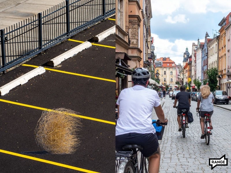
The idea of riding a bike to work, the park, the store, or the coffee shop is appealing to many Spokanites, but it can be out of reach for all but the bravest. Thankfully, there is a stack of new infrastructure projects scheduled for construction before 2030 that will make riding more feasible for more folks.
Studies — like this one showing around half of metro-area residents are interested in cycling for transport, but are held back by concerns about safety — suggest we’d have more people riding bikes in Spokane if cycling felt safer.
My in-laws are in the “interested but concerned” category. They love their e-bikes and have a strong desire to cycle for regular transportation, but the lack of safe routes here discourages them. Spokane County has miles of bike infrastructure, but much of it is simply painted bike lanes, which provide no physical protection and can make even the bravest and most experienced cyclists among us nervous. My in-laws much prefer to ride on off-street paths, and would ride in protected lanes if given the chance.
This is a guide to the current and upcoming bike network for my in-laws and everyone else in the “interested but concerned” category. You might be surprised by how many routes already exist and even more surprised by the list of routes planned for construction before 2030.
I also gave each route an “in-law-friendliness score,” so you’ll know how bike-curious folks may fare. (The ✨emoji indicates a ½ star)
You can explore the map of all these projects here. If I’ve missed any that you know of, let me know so I can add them to the map.
I know it can be time-consuming and scary to find a route between your destinations, so I’d like to help. Email me and I’ll send you the most in-law friendly route I can think of.
(By the way, a bunch of these projects are funded directly or indirectly by Washington’s Climate Commitment Act, which could get repealed this November by I-2117.)
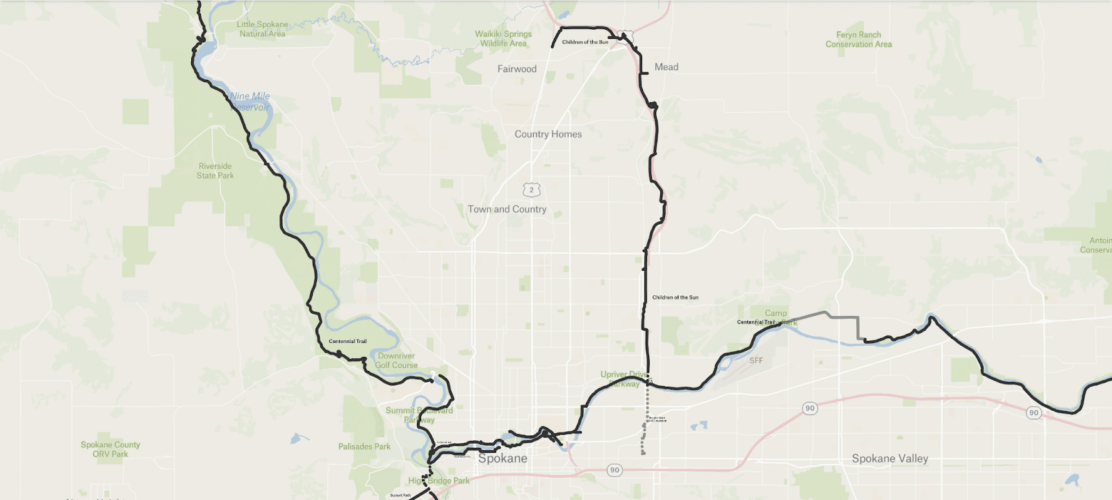
Centennial Trail
In-law-friendliness score: ⭐⭐⭐⭐✨

The Centennial Trail (CT) is a mostly off-street paved path from Nine Mile Falls, through Spokane and east to Coeur D’Alene that is used widely for both recreation and transportation. Most of its sixty-four miles are in-law-friendly, with a couple notable exceptions.
The Gaps
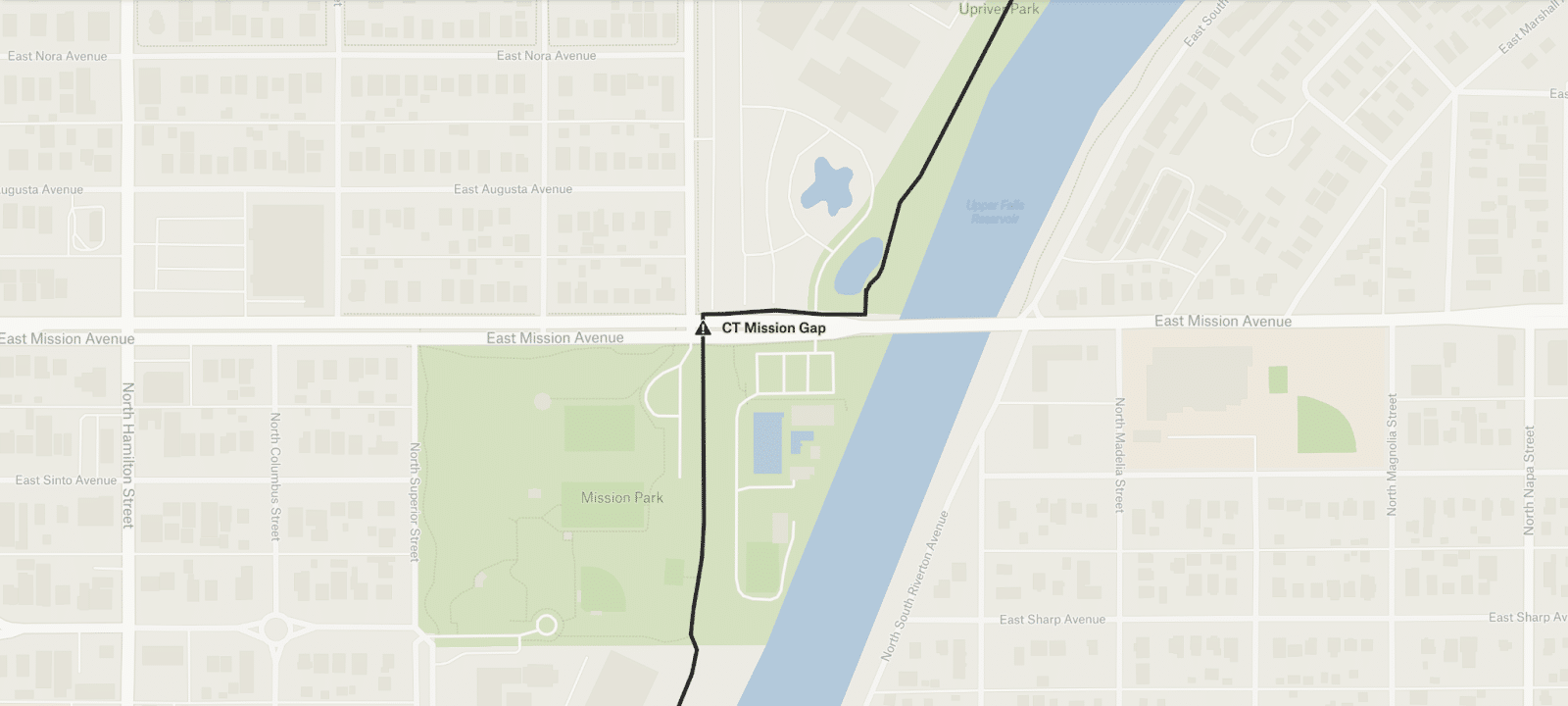
The trail crossing at Mission Avenue requires riding the sidewalk and crossing a train track. The city has studied several different solutions for this over the years. The current plan includes a bridge over Mission and a tunnel under the train tracks, but unfortunately this project is not yet funded.
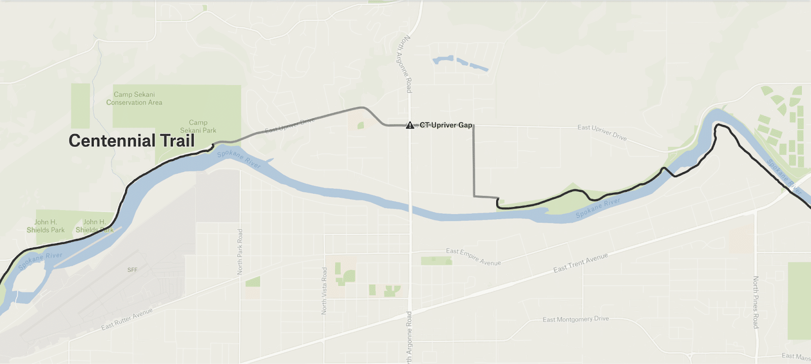
In Spokane Valley, the Trail uses the narrow shoulders of Upriver Drive, which has high vehicle speeds and meets Argonne Road in an uncomfortable, shoulderless intersection.
South Gorge Trail
In-law-friendliness score: ⭐⭐⭐⭐✨

This is a partially off-street and partially curb-height, sidewalk-style asphalt trail that runs from the Sandifur Bridge to Monroe Street in Peaceful Valley.
The Gap
There’s a walkway that runs under the south end of the Monroe Street Bridge, but it is pedestrian-only, so you’d have to walk your bike or brave the hairball intersection at Monroe Street/Spokane Falls Boulevard/Riverside Avenue (which is surely not in-law-friendly). I wish the Southside underpass had been designed to be rideable.
Fish Lake Trail
In-law-friendliness score
Now: ⭐⭐⭐
By 2030: ⭐⭐⭐⭐⭐
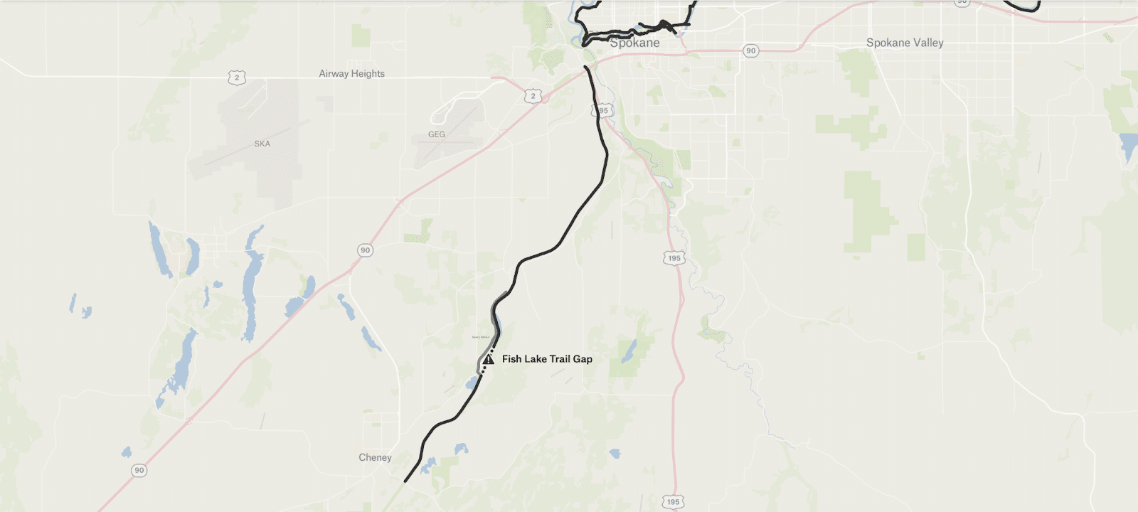
The Fish Lake Trail (FLT) is an off-street, beautiful, nearly 15-mile rail-trail that runs (almost) continually from Spokane to Cheney. The north portion is well-traveled by recreating Spokanites but the south portion is out of the way for those in the city, so it may be less known. I would recommend a visit though — it runs through a narrow basalt canyon with a creek on either side.
Both the north and south portions feature a smooth and shaded path with a gentle 1% southbound grade, and are undoubtedly in-law-friendly.
The Gap
Unfortunately, there is a gap about 10 miles south of Spokane, where the trail is unfinished due to an existing rail line. To continue, one is forced onto Cheney-Spokane Road for a mile-long detour that can get pretty harrowing due to the soft shoulder and traffic speeds on the busy rural route. This gap takes the otherwise very in-law-friendly trail down to a 3.

Good news: the city of Spokane has funded a project to bridge the roughly one-mile gap, which consists of a bridge over the train track and paving the remainder. It’s planned for 2028.
Connecting the Centennial Trail and Fish Lake Trail
In-law-friendliness score
Now: ⭐⭐⭐✨
By 2030: ⭐⭐⭐⭐⭐

To get from CT to FLT, I ride down the windy switchback trail from Kendall Yards and across a footbridge, which is all very in-law-friendly. After that, though, there’s a long stretch west on Riverside Ave – which at least doesn’t have much traffic – then south on Government Way – definitely not in-law-friendly.
Fortunately, the city has a plan: The solution could bridge over Latah Creek, wind up through High Bridge Park, parallel Government Way, cross Sunset Highway (and the Sunset Path*) and end at the existing FLT trailhead. This project is partially unfunded, but I’m hopeful it will be completely funded and constructed by 2030.
Imagine the safe routes unlocked by this connection: anywhere along the Centennial Trail all the way to Cheney.
*What’s a Sunset Path? Allow me.
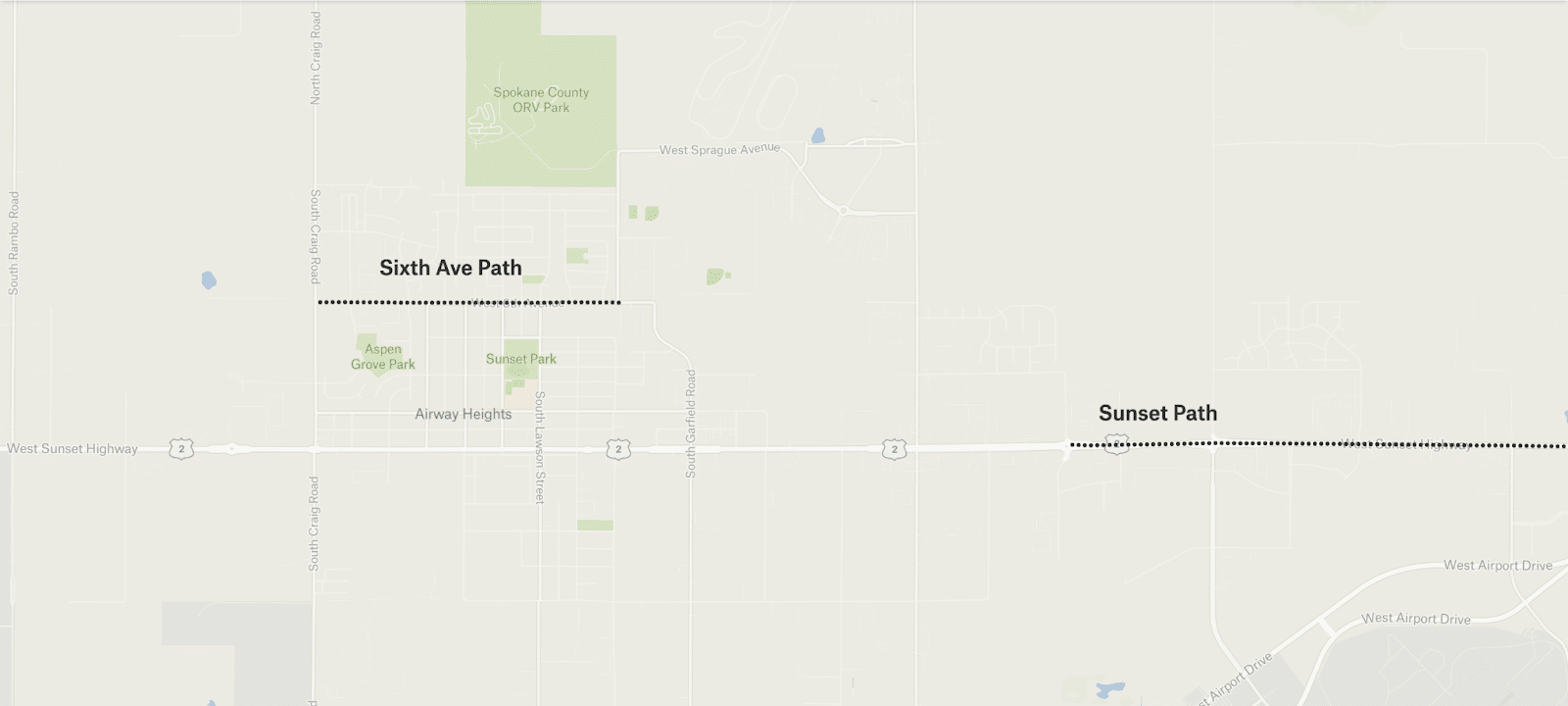
Sunset Path
In-law-friendliness score: ⭐⭐⭐✨

It’s essentially a wide asphalt sidewalk on the northside of Sunset Highway between Government Way and Assembly Road, but unfortunately is not well protected, so I’d call it “just barely in-law-friendly.” The city of Spokane has plans for it to run to Deer Heights Road by 2026. It could be a decent connection between the West Plains and downtown Spokane, especially once the Centennial Trail to Fish Lake Trail connection is done.
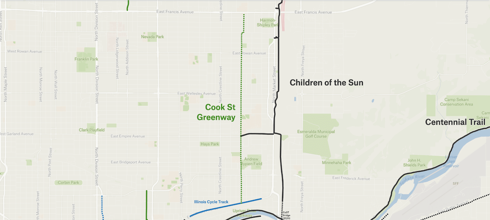
Children of the Sun Trail
In-law-friendliness score
Now: ⭐⭐⭐⭐✨
By 2030: ⭐⭐⭐⭐⭐
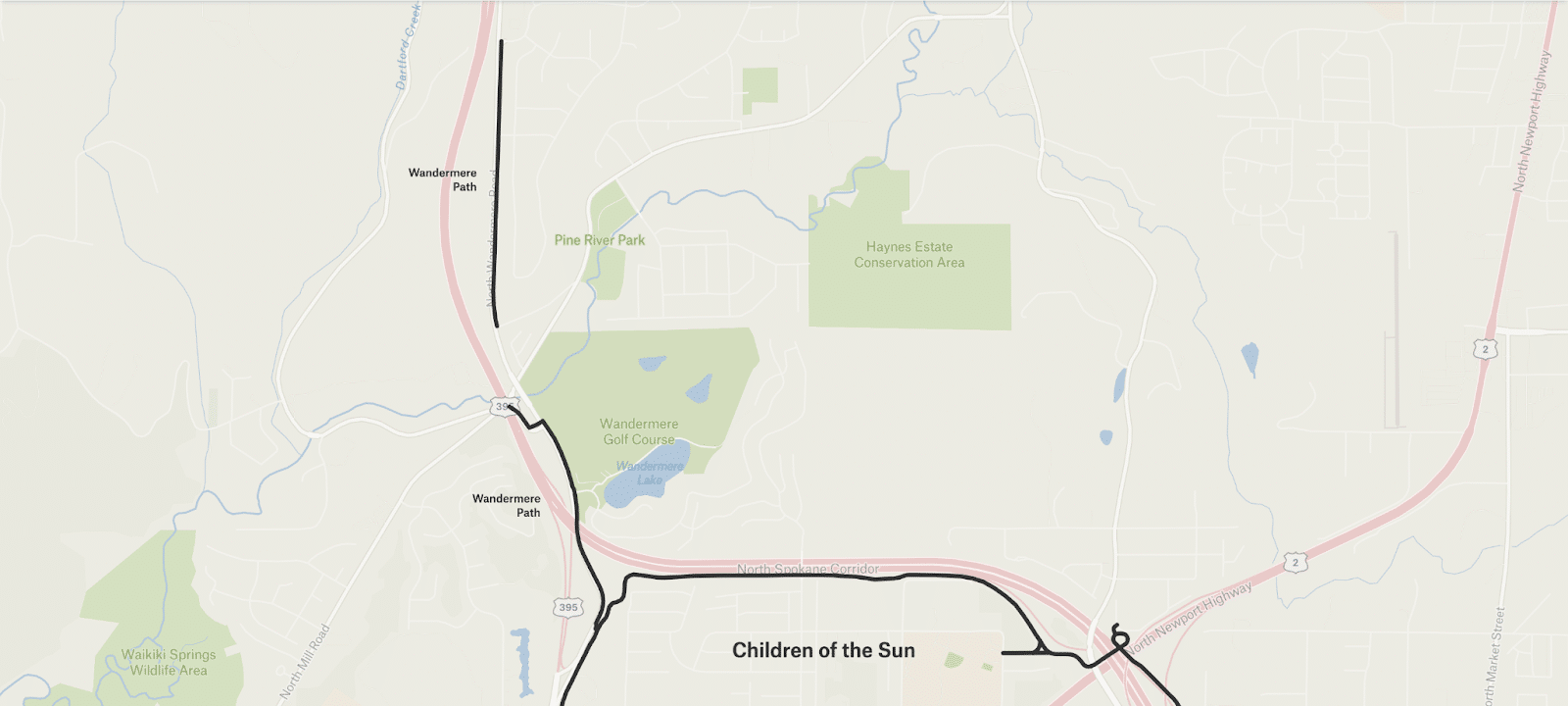
The Children of the Sun Trail (CoST) is a mostly flat, low-stress, off-street path that runs from Wandermere to (nearly) the Spokane River alongside the North Spokane Corridor.
It has no scary gaps, but it currently ends quite suddenly in very chunky railroad ballast at Marietta Ave – a spot with few destinations.
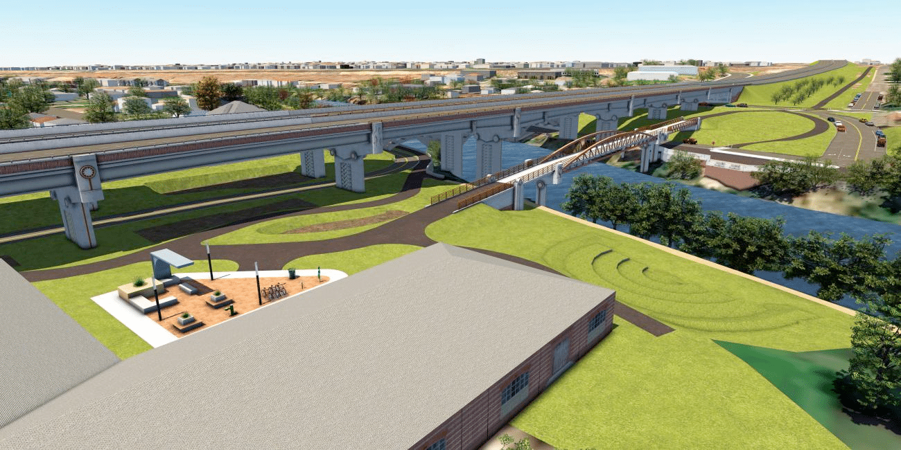
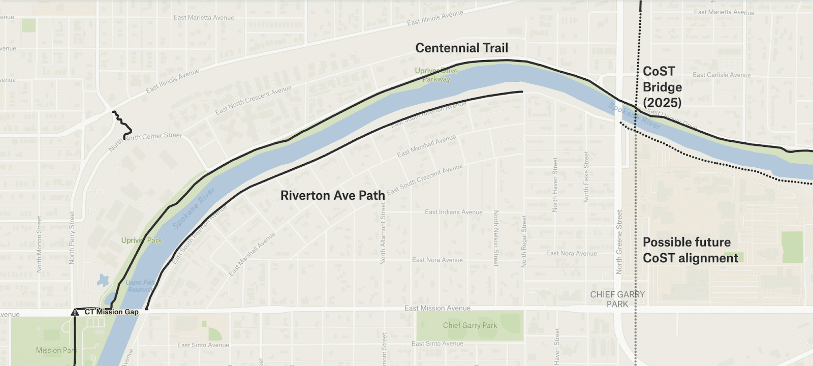
The next stage of the project will extend the trail south, first hitting Upriver Drive and the Centennial Trail, then bridging across the Spokane River to Spokane Community College. The south bank of the river could house a landing with connections to a sidewalk-style bike path on Riverton Avenue to the west and Millwood Trail to the east.

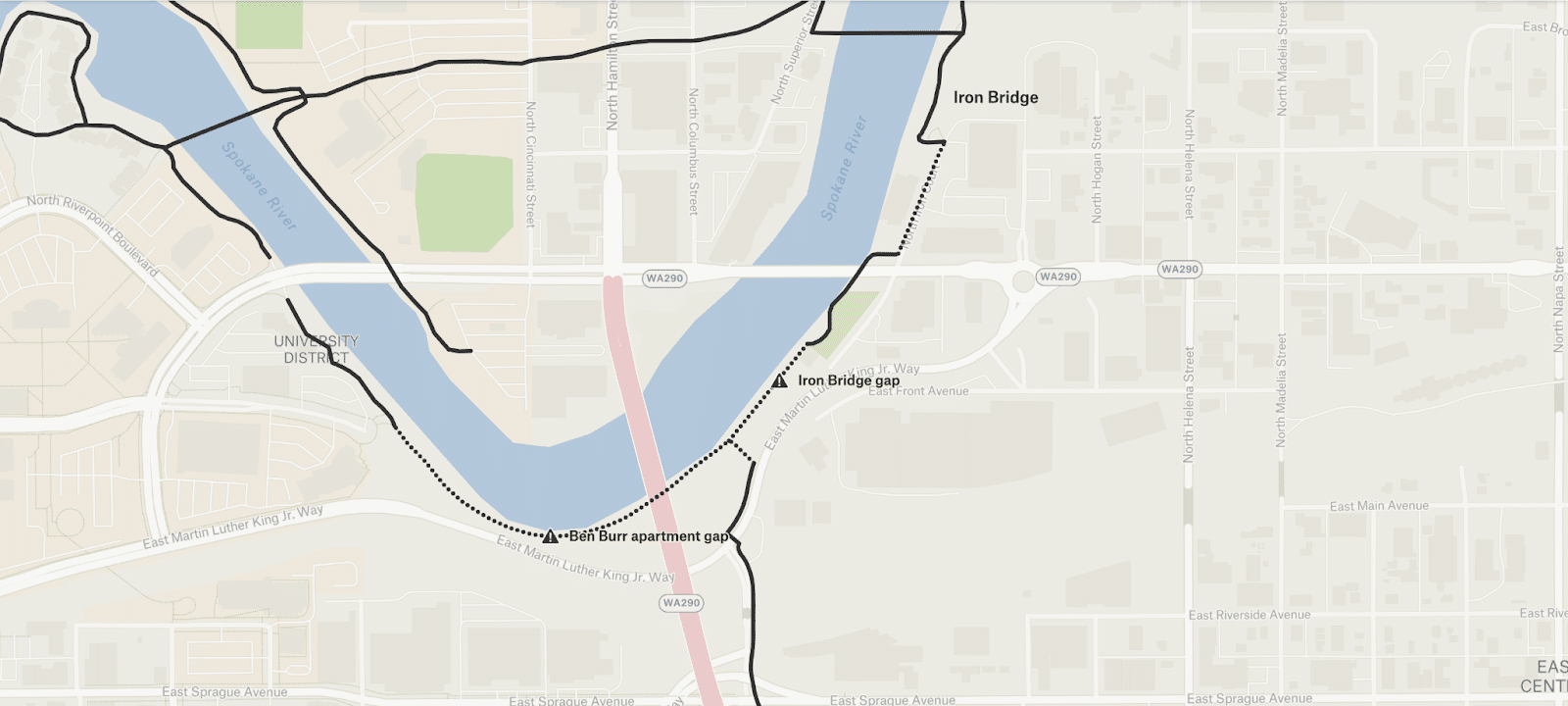
Ben Burr Trail
In-law-friendliness score: ⭐⭐⭐⭐

The Ben Burr Trail (BBT) is a bike path connecting the University District and South Logan neighborhoods to much of East Central, which allows for short connections on residential streets to South Perry and nearly to Lincoln Heights. It runs along the south bank of the Spokane River in the University District, under the Hamilton Street bridge and I-90 then into Liberty Park, where it starts a gentle climb through a forested ravine. It ends at 11th and Fiske Street, a residential area.
BBT gets close to the Centennial Trail (if only there was a better connection under Spokane Falls Boulevard) and could connect to both the future Pacific Ave Greenway and a land bridge over I-90.
The Gaps
- Under Hamilton Street while an apartment complex is being built
- The city hopes to connect the BBT and the Iron Bridge
Millwood Trail
In-law-friendliness score
Now: ⭐⭐⭐⭐ (minus one for Argonne intersection)
By 2030: ⭐⭐⭐⭐✨

The cities of Spokane, Spokane Valley and Millwood are collaborating on Millwood Trail, which would run east from Spokane Community College to Millwood — a cute little town of mid-century ranchers and a century-old retail corridor surrounded on all sides by Spokane Valley.
From Spokane, running east:
- Spokane plans to build the Millwood Trail from SCC to Felt’s Field – along the Spokane River – in 2026 and 2027. This section would connect to the Children of the Sun’s southbank landing and an on-street path that runs along Riverton Avenue.
- Spokane Valley hopes to continue to trail from Felt’s Field to Millwood, but that is as-yet unfunded.
- The tiny city of Millwood has already constructed its portion.
- There’s a concept for continuing the trail to Sullivan Park, but it is unplanned and unfunded.
Appleway Trail
In-law-friendliness score: ⭐⭐⭐⭐

The Appleway Trail runs parallel to the Sprague-Appleway couplet from Farr Road to roughly Barker Road. It’s a paved trail that is partially off-street and partially curb-height, like a sidewalk. This portion is fairly in-law friendly, but has an awkward start on the west and an awkward intersection at University Road.
The city of Liberty Lake is planning to extend the Appleway Trail to Kramer Parkway in 2028. And the Valley hopes to someday extend the trail westward to Dishman-Mica Road, but that is as yet unfunded.
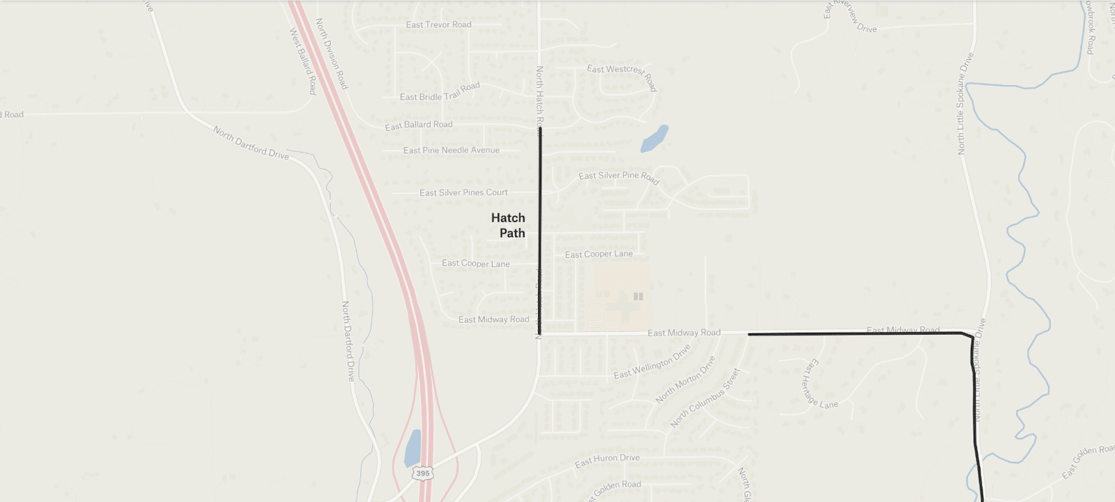
A few shorter shared-use paths that may be useful

Protected bike lanes
Protected bike lanes and greenways of course carry a bit more risk than trails, but allow those on bikes to navigate the urban grid in ways trails cannot.
Existing protected bike lanes:
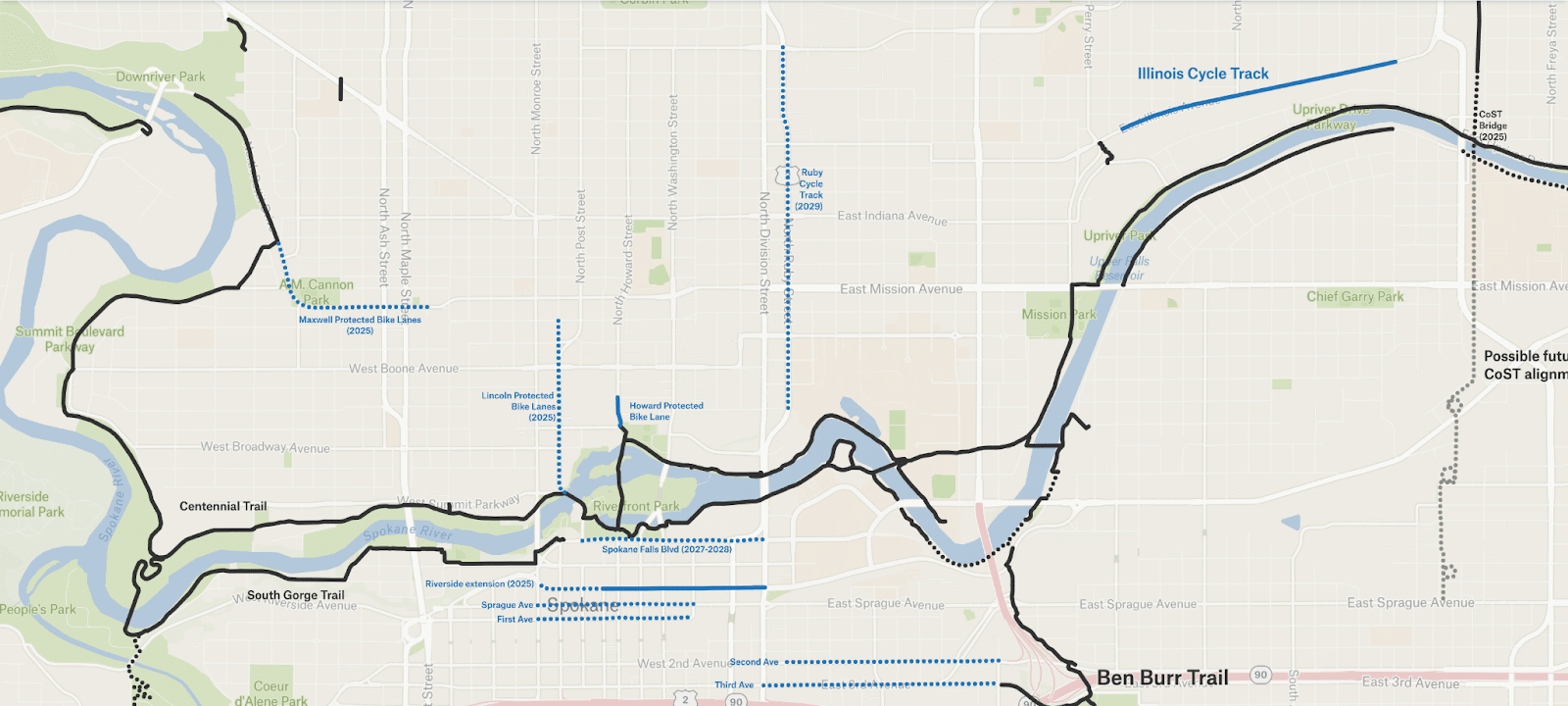
- Illinois from Madelia to Haven: a two-way cycle track (protected by a curb) along a small bluff in east Spokane. ⭐⭐⭐⭐(minus one star due to its very awkward beginning and end)
- Riverside from Division to Wall. Wall to Monroe will be built in 2026. ⭐⭐⭐⭐(minus one star due to conflict points)
- Howard from Mallon to Cataldo. This tiny one-block stretch’s jersey barriers provide excellent protection. I hope its level of protection will be a model for future projects. ⭐⭐⭐⭐⭐(just wish it was longer!)
Future protected lanes:
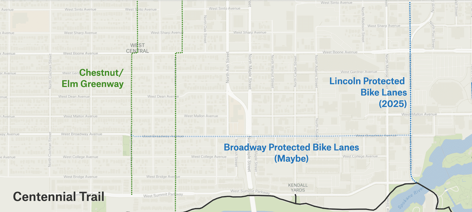
- Lincoln from Summit to Sinto; planned for 2025.
- Maxwell from Pettet to Walnut; planned for 2025.
- Spokane Falls Boulevard from Division to Post: the 2027-2028 rebuild could include protected bike lanes heading both east and west.
- Ruby Street: As part of the Division Bus Rapid Transit project, a two-way cycle track is planned.
Spokane won a $12 million United States Department of Transportation (USDOT) grant to improve pedestrian and bike infrastructure. The grant application’s example projects included protected bike lanes on:
- Sprague from Maple to Bernard.
- First Avenue from Maple to Bernard.
- Second Avenue from Pine to Arthur.
- Third Avenue from Division to Arthur.
Greenways
If you’re not familiar, greenways are usually neighborhood streets designed for local vehicle traffic only, which creates a fairly quiet route for those on bikes.

The Cincinnati Greenway is a solid north-south route that runs from Gonzaga to Foothills Dr. It still has a fair amount of car traffic and visibility can be limited. Its best feature is the bike-specific crossing on Indiana. ⭐⭐⭐✨
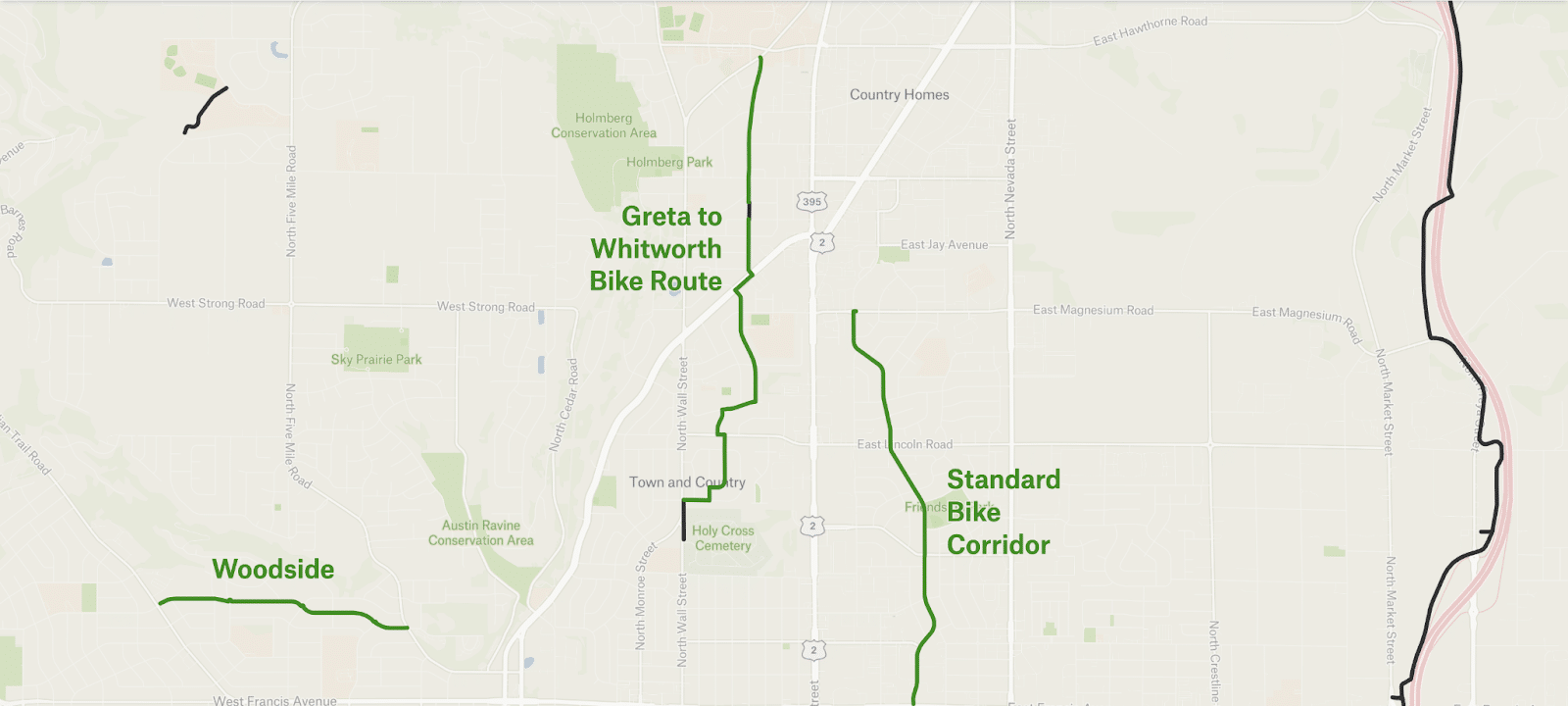
The County recently built the Greta to Whitworth bike route, which is fairly comfortable. It includes a pedestrian crossing at Country Homes. ⭐⭐⭐⭐ (The Woodside and Standard Corridors are also decent.)
Future greenways


Some potential projects
These projects may happen, but either don’t have funding or aren’t designed yet.


And here’s an overview look of the whole network
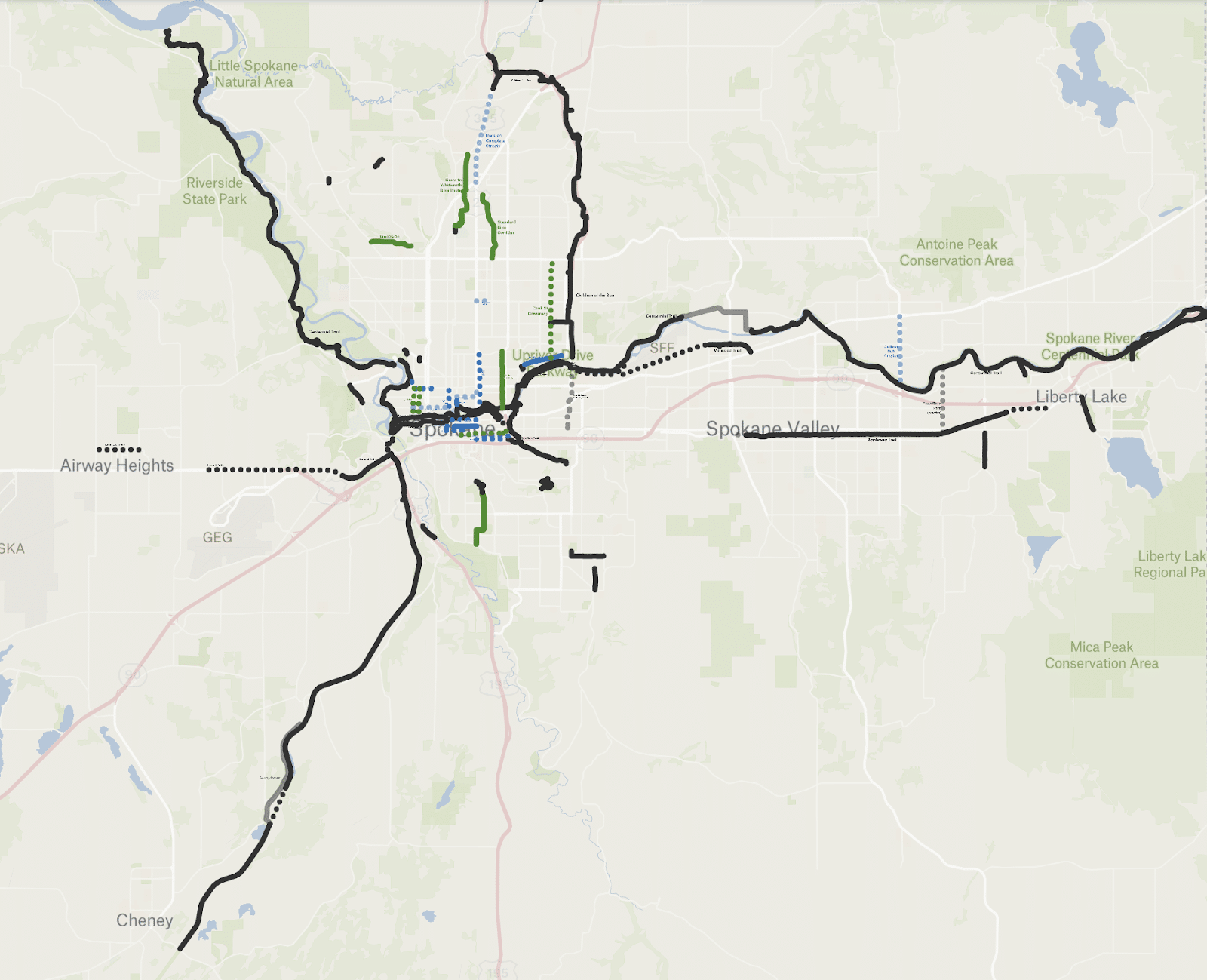
Once again, you can explore the map of all these projects plus a few more little ones (I couldn’t help myself) here.
Basemaps courtesy of OpenStreetMap and Felt.